
ActionMap
Unified Command for Incident Management and Responder Collaboration
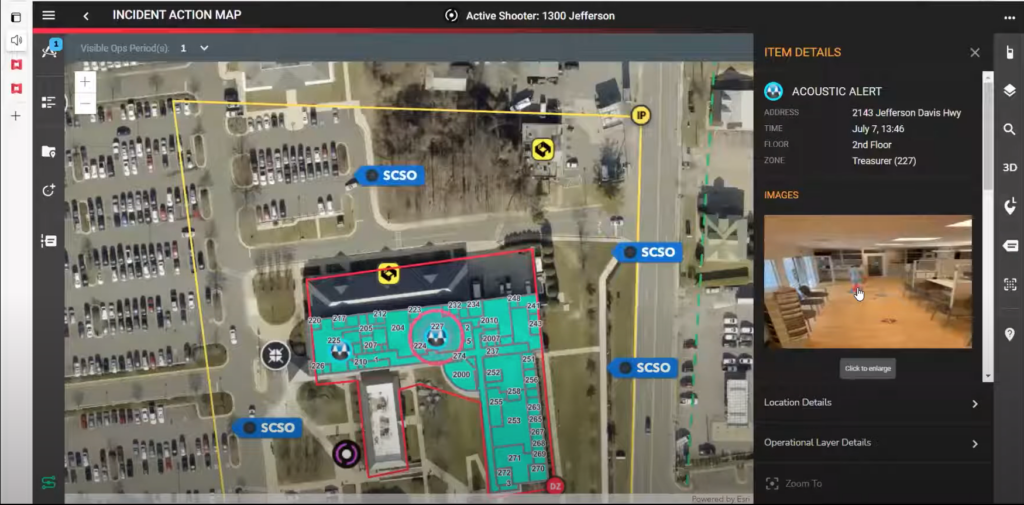
AWARE’s ActionMap provides a real-time, ArcGIS™ based mapping platform for the command staff and responders to plan, share, and track ICS workflows from the start to finish of an event.
ActionMap ensures everyone associated with an incident from the dispatcher, to the incident commander, to the responders in the field are all looking at exactly the same information as the incident develops. ActionMap can be displayed on a tablet at the scene, on a vehicle’s MDT, on a large screen in an Emergency Operations Center, on a dispatcher’s computer, or on any responder’s smartphone.
Action Map
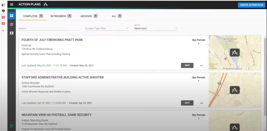
ActionMap easily incorporates locally generated GIS data layers including critical infrastructure, hospitals, schools, etc. ActionMap displays real-time video, audio transcription, pictures, GPS locations, known hazards, or other location factors that can impact response and rescue efforts. ActionMap provides the user the ability to generate, upload, and store pre-plans and Incident Action Plans (IAP).
Increased Control, Knowledge, and Real-Time Incident Status
ActionMap provides a unified platform where all incident information can be centrally collected, viewed, organized, and shared resulting in increased situational awareness. This data can be securely shared with specific users and teams or across agencies for enhanced collaboration.
Benefits of ActionMap for Incident Response and Management
Real-Time Visibility
Fully-integrated, real-time incident management platform
Data Collection and Sharing
Upload and store pre-plan and Incident Action Plans (IAP)
Activity Log
Ability to track activity through an incident for easier After-Action reports
Location-based tracking
Ability to view and track location of each responder in real-time